Mount Kilimanjaro
Umbwe Route
The steepest, most direct route up Kilimanjaro.
- Durée
- 6 à 7 jours
- Distance
- 53 km
- Sommet
- 5,895 m
- Hébergement
- Camping
- Affluence
- Calme
- Difficulté
- Très difficile
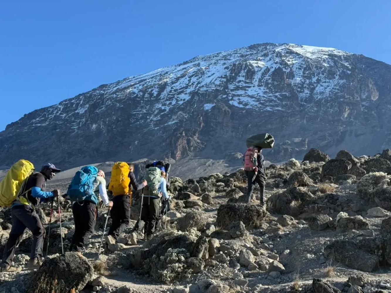
The Umbwe Route climbs a narrow forested ridge straight up Kilimanjaro's southern slopes to the Barranco Valley. It is short, steep and quiet, and best suited to fit, experienced trekkers.
At about 53 km, Umbwe is the shortest route to Uhuru Peak and by far the steepest. From Umbwe Gate the trail climbs a knife-edged ridge between two deep river gorges, so steep in places that you pull yourself up on tree roots. In two days you gain more than 2,300 m, from the gate at 1,640 m to Barranco Camp at 3,960 m.
A Ridge Through the Forest
The first day is spent in some of the densest and least disturbed rainforest on the mountain, ending at Umbwe Cave Camp (2,850 m). The second day breaks out of the trees onto a rocky spine with the Barranco Valley falling away on one side and, in clear weather, the whole Western Breach and southern icefields ahead.
Why Altitude Is the Real Challenge
Umbwe's fast ascent gives the body little time to adjust, which is why its summit success rate is lower than on longer routes. Our "modified" Umbwe itinerary adds a night at Karanga Camp on the southern circuit, turning the push to high camp into two short days and giving you a better chance on summit night.
From Barranco to the Summit
At Barranco Camp Umbwe joins the Machame and Lemosho routes: up the Barranco Wall, across to Karanga, then to high camp and the crater rim at Stella Point. The descent is by the Mweka Route.
Pourquoi choisir cette voie
- The most direct line to the Barranco Valley
- A dramatic ridge climb through untouched rainforest
- Very few other climbers for the first two days
- Views into the Western Breach from the upper ridge
Bon à savoir
- Steep and sustained: not recommended for a first high-altitude trek
- Fast height gain means a higher risk of altitude sickness
- The ridge is slippery after rain
- Our climbs summit from Kosovo Camp (4,800 m), a permit-only camp above Barafu that shortens summit night by about an hour.
Carte de la voie
Carte de la Umbwe Route
Le sentier tel qu’il est sur le terrain, avec chaque porte, camp et point haut. Touchez un lieu dans la liste pour le trouver sur la carte.
Altitude
Profil d’altitude
Jusqu’où vous montez, et où vous dormez. Les creux de la courbe sont des journées « monter haut, dormir bas », qui aident votre corps à s’adapter.
Jour par jour
Itinéraire de la Umbwe Route
Voici le programme de notre circuit « Kilimandjaro, voie Umbwe – 6 jours ».
Route depuis Arusha jusqu’à la porte d’Umbwe, puis montée raide à travers une forêt tropicale dense, en s’aidant des racines comme de marches, le long d’une crête étroite jusqu’au camp proche des grottes d’Umbwe.
Nuit: Camp Umbwe Cave
On continue sur la crête à travers bruyères et lande, avec des vues spectaculaires sur la Western Breach, avant de descendre dans la vallée de Barranco pour camper parmi les séneçons géants.
Nuit: Camp Barranco
Escalade facile du Barranco Wall, puis le circuit sud jusqu’au camp Karanga. C’est cette nuit supplémentaire qui rend notre voie Umbwe « modifiée » : elle laisse à votre corps le temps de s’acclimater.
Nuit: Camp Karanga
Montée à travers le désert alpin, au-delà de Barafu, jusqu’au camp de Kosovo, le camp de base le plus élevé, qui raccourcit la nuit du sommet. Dîner tôt et repos avant la tentative au sommet.
Nuit: Camp Kosovo
Réveil vers minuit et ascension à la lampe frontale depuis le camp de Kosovo, sur les pentes d’éboulis, jusqu’à Stella Point sur le bord du cratère, que l’on atteint au lever du soleil sur le Mawenzi. De là, environ une heure le long du cratère, au pied des glaciers, mène à l’Uhuru Peak, le point culminant de l’Afrique. Après les photos au sommet, descente jusqu’au camp Mweka, en forêt, pour un dîner et un repos bien mérités.
Nuit: Camp Mweka
Une dernière descente à travers la forêt tropicale, souvent avec des colobes dans les arbres, jusqu’à la porte de Mweka. Remise du certificat de sommet, au revoir à l’équipe et retour à Arusha pour une douche chaude et un dîner de célébration.
Nuit: Arusha
Bon à savoir
Umbwe Route : questions fréquentes
How hard is the Umbwe Route? +
It is the hardest of the standard routes: the first two days are very steep, and the fast ascent leaves little time to acclimatise. It suits fit trekkers with previous experience at altitude.
Is the Umbwe Route technical? +
No. It is steep and you use your hands on roots and rock in places, but no ropes or climbing skills are required.
How many days does the Umbwe Route take? +
Six or seven days. Our six-day "modified" Umbwe includes a night at Karanga Camp to improve acclimatisation.
Comparer
Autres voies du Mount Kilimanjaro
 6 à 7 jours
Nous la proposons
6 à 7 jours
Nous la proposons
The "Whiskey" Route
Machame Route
Kilimanjaro's most popular route: rainforest, the Lava Tower and the Barranco Wall.
- Distance
- 62 km
- Difficulté
- Exigeante
- Hébergement
- Camping
- Affluence
- Très fréquentée
 7 à 8 jours
Nous la proposons
7 à 8 jours
Nous la proposons
Lemosho Route
The most beautiful way up: a quiet western start across the Shira Plateau.
- Distance
- 70 km
- Difficulté
- Exigeante
- Hébergement
- Camping
- Affluence
- Fréquentation moyenne
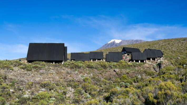 5 à 6 jours
The "Coca-Cola" Route
Marangu Route
The only Kilimanjaro route with mountain huts instead of tents.
- Distance
- 72 km
- Difficulté
- Modérée
- Hébergement
- Refuges
- Affluence
- Très fréquentée
Prêt à gravir le Mount Kilimanjaro ?
Indiquez-nous vos dates, votre forme et ce que vous souhaitez voir. Nous vous recommanderons la montagne et la voie qui vous offrent les meilleures chances d’une belle ascension.
Plan Your Safari