Mount Kilimanjaro
Lemosho Route
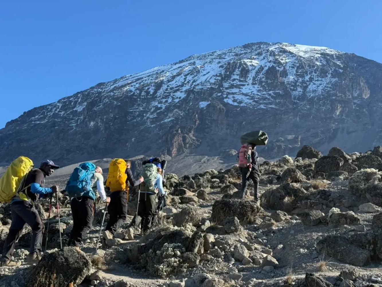
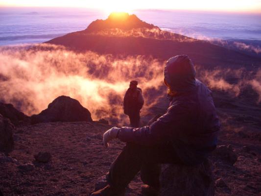
The most beautiful way up: a quiet western start across the Shira Plateau.
Photo: Stig Nygaard, CC BY 2.0
- Durée
- 7 à 8 jours
- Distance
- 70 km
- Sommet
- 5,895 m
- Hébergement
- Camping
- Affluence
- Fréquentation moyenne
- Difficulté
- Exigeante
The Lemosho Route approaches Kilimanjaro from the remote west, crosses the whole Shira Plateau and joins the southern circuit. Eight days give excellent acclimatisation and one of the highest summit success rates.
Lemosho is widely considered the most beautiful route on Kilimanjaro. After registering at Londorossi Gate on the far western side of the mountain, you drive to the Lemosho trailhead at about 2,100 m and walk into some of the least-visited rainforest on Kilimanjaro, where black-and-white colobus monkeys are common and buffalo and elephant tracks are sometimes seen.
Across the Shira Plateau
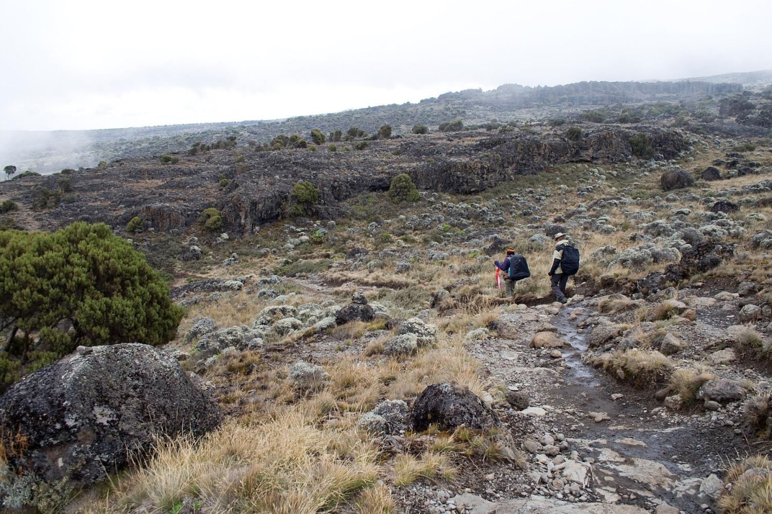
On day two the forest opens onto the Shira Plateau, the remains of Kilimanjaro's oldest volcano, which collapsed some 500,000 years ago. Lemosho is the only route that crosses the whole plateau from west to east, with Kibo's glaciers growing ahead of you for two days. From Shira 2 Camp an optional walk leads to Shira Cathedral for views over the plateau's southern edge.
Joining the Southern Circuit
At the Lava Tower (4,630 m) Lemosho joins the Machame Route and shares its finest days: the descent to Barranco Camp, the Barranco Wall and the traverse to Karanga. By then you have already spent four nights above 2,800 m, which is why climbers on Lemosho arrive at high camp in better shape than on the shorter routes.
Seven or Eight Days
The eight-day itinerary sleeps at both Shira 1 and Shira 2; the seven-day version walks from Mti Mkubwa to Shira 2 in one long day. We recommend eight days: the extra night costs little effort and is the best insurance for the summit.
Pourquoi choisir cette voie
- A remote western start with far fewer people for the first three days
- The full crossing of the Shira Plateau, with Kibo ahead of you
- Five nights of acclimatisation before high camp on the eight-day climb
- The Lava Tower, Barranco Wall and southern glaciers, shared with Machame
Bon à savoir
- The drive to Londorossi Gate is longer than to the southern gates
- From the Lava Tower onwards the trail is shared with Machame and gets busier
- Camping only
- Our climbs summit from Kosovo Camp (4,800 m), a permit-only camp above Barafu that shortens summit night by about an hour.
Carte de la voie
Carte de la Lemosho Route
Le sentier tel qu’il est sur le terrain, avec chaque porte, camp et point haut. Touchez un lieu dans la liste pour le trouver sur la carte.
Altitude
Profil d’altitude
Jusqu’où vous montez, et où vous dormez. Les creux de la courbe sont des journées « monter haut, dormir bas », qui aident votre corps à s’adapter.
Jour par jour
Itinéraire de la Lemosho Route
Voici le programme de notre circuit « Kilimandjaro, voie Lemosho – 8 jours ».
Route depuis Arusha jusqu’à la porte de Londorossi pour l’enregistrement, puis jusqu’au départ du sentier Lemosho. La première marche serpente dans une forêt tropicale de montagne intacte, peuplée de colobes et de nombreux oiseaux, jusqu’au camp installé sous les arbres géants.
Nuit: Camp Mti Mkubwa
On quitte la forêt pour les bruyères géantes et la lande, en montant jusqu’au bord du plateau de Shira, avec les premières grandes vues sur le Kibo, le cône sommital.
Nuit: Camp Shira 1
Une journée facile à travers le plateau, avec un détour possible par la Shira Cathedral, aide votre corps à s’acclimater. Les soirs de beau temps, le mont Meru semble flotter au-dessus des nuages, à l’ouest.
Nuit: Camp Shira 2
Montée jusqu’au Lava Tower pour le déjeuner, puis descente dans la vallée de Barranco parmi les séneçons géants. Monter haut et dormir plus bas est l’une des meilleures façons de s’acclimater.
Nuit: Camp Barranco
Escalade facile du Barranco Wall, un temps fort de l’ascension qui demande de s’aider des mains mais aucune technique, puis le circuit sud par crêtes et vallées jusqu’au camp Karanga.
Nuit: Camp Karanga
Montée à travers le désert alpin, au-delà de Barafu, jusqu’au camp de Kosovo, le camp de base le plus élevé, qui raccourcit la nuit du sommet. Dîner tôt et repos avant la tentative au sommet.
Nuit: Camp Kosovo
Réveil vers minuit et ascension à la lampe frontale depuis le camp de Kosovo, sur les pentes d’éboulis, jusqu’à Stella Point sur le bord du cratère, que l’on atteint au lever du soleil sur le Mawenzi. De là, environ une heure le long du cratère, au pied des glaciers, mène à l’Uhuru Peak, le point culminant de l’Afrique. Après les photos au sommet, descente jusqu’au camp Mweka, en forêt, pour un dîner et un repos bien mérités.
Nuit: Camp Mweka
Une dernière descente à travers la forêt tropicale, souvent avec des colobes dans les arbres, jusqu’à la porte de Mweka. Remise du certificat de sommet, au revoir à l’équipe et retour à Arusha pour une douche chaude et un dîner de célébration.
Nuit: Arusha
Bon à savoir
Lemosho Route : questions fréquentes
Is Lemosho better than Machame? +
They share the same summit approach, but Lemosho starts further west, is quieter for the first three days and spends longer acclimatising. If you have eight days, Lemosho gives you the better chance of reaching the top.
How many days does the Lemosho Route take? +
Seven or eight days on the mountain. We run it over eight days, sleeping at both Shira 1 and Shira 2 camps.
Where does the Lemosho Route start? +
You register at Londorossi Gate (2,250 m) on the western side of Kilimanjaro, then drive to the Lemosho trailhead at about 2,100 m, where the walk begins.
Comparer
Autres voies du Mount Kilimanjaro
 6 à 7 jours
Nous la proposons
6 à 7 jours
Nous la proposons
The "Whiskey" Route
Machame Route
Kilimanjaro's most popular route: rainforest, the Lava Tower and the Barranco Wall.
- Distance
- 62 km
- Difficulté
- Exigeante
- Hébergement
- Camping
- Affluence
- Très fréquentée
 5 à 6 jours
The "Coca-Cola" Route
Marangu Route
The only Kilimanjaro route with mountain huts instead of tents.
- Distance
- 72 km
- Difficulté
- Modérée
- Hébergement
- Refuges
- Affluence
- Très fréquentée
 6 à 7 jours
Nous la proposons
6 à 7 jours
Nous la proposons
Rongai Route
The quiet northern approach, from the Kenyan border side.
- Distance
- 73 km
- Difficulté
- Modérée
- Hébergement
- Camping
- Affluence
- Calme
Prêt à gravir le Mount Kilimanjaro ?
Indiquez-nous vos dates, votre forme et ce que vous souhaitez voir. Nous vous recommanderons la montagne et la voie qui vous offrent les meilleures chances d’une belle ascension.
Plan Your Safari